
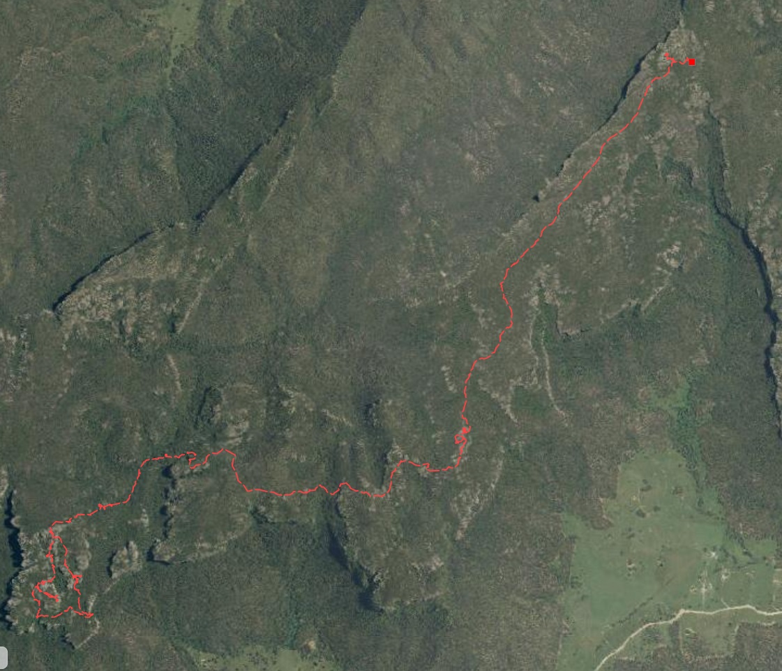
Grand Traverse
The Wolgan Capertee Divide is a range of connected mesas and mountains that separate the watersheds of the Wolgan and Capertee Rivers. The Skyline Traverse is a magnificent 3 day walk along the divide.
The Wolgan River runs through the Wolgan Valley to the south of the divide. The Capertee River runs through the Capertee Valley to the north.
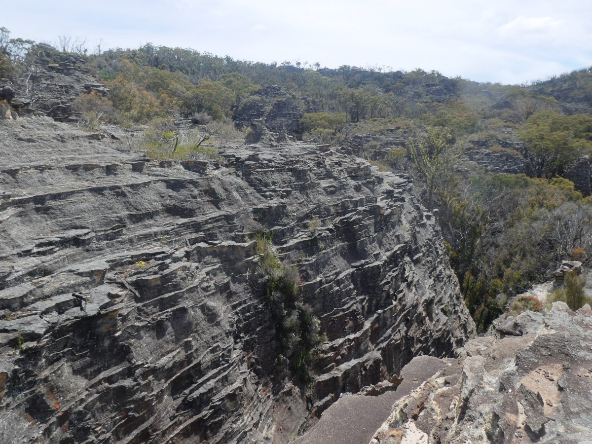
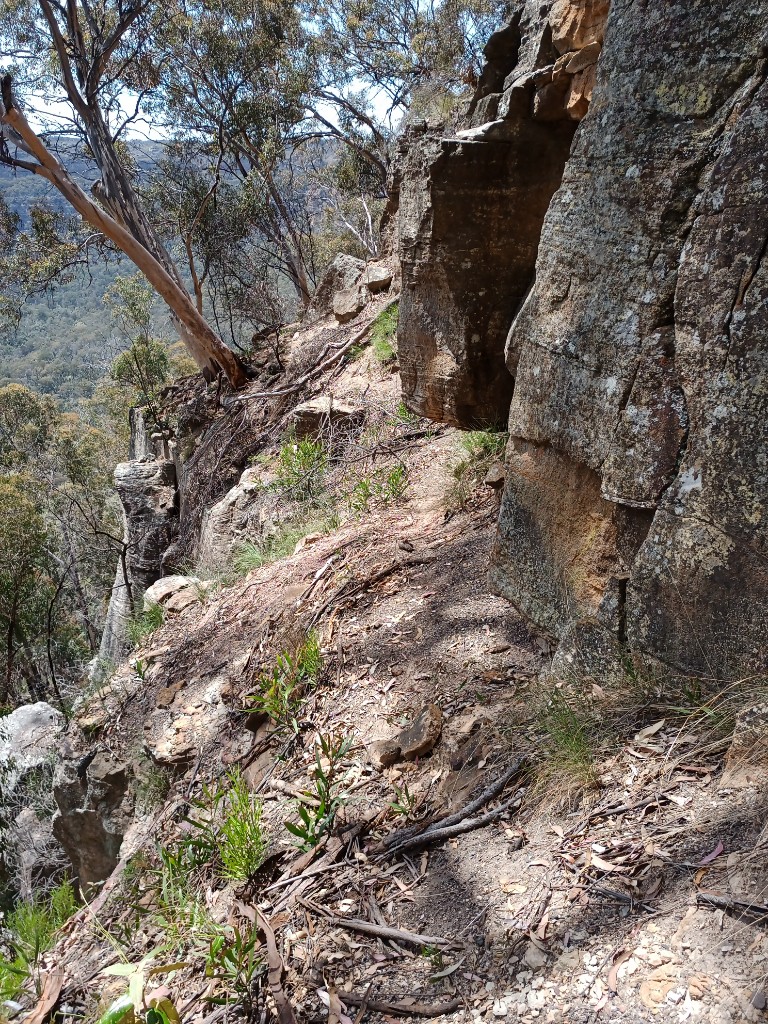
The cliff lines are high and sheer. There are Passes and Gaps that allow access to the top of the divide and in some place through to the valley on the other side.
Walking along the divide is fairly easy. Water is hard to find and often needs to be carried.
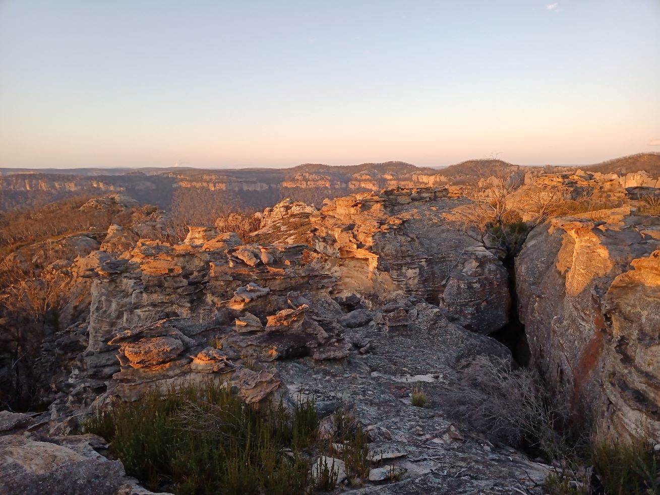
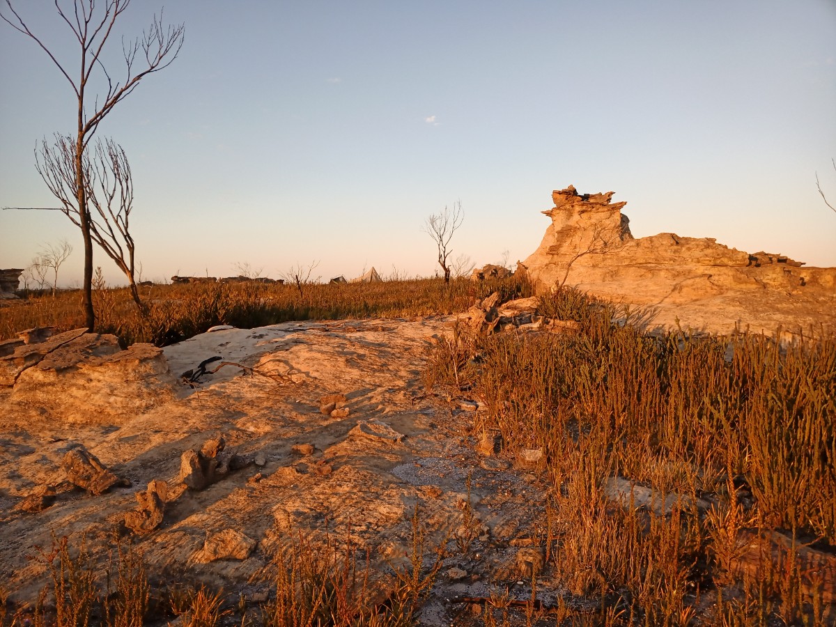
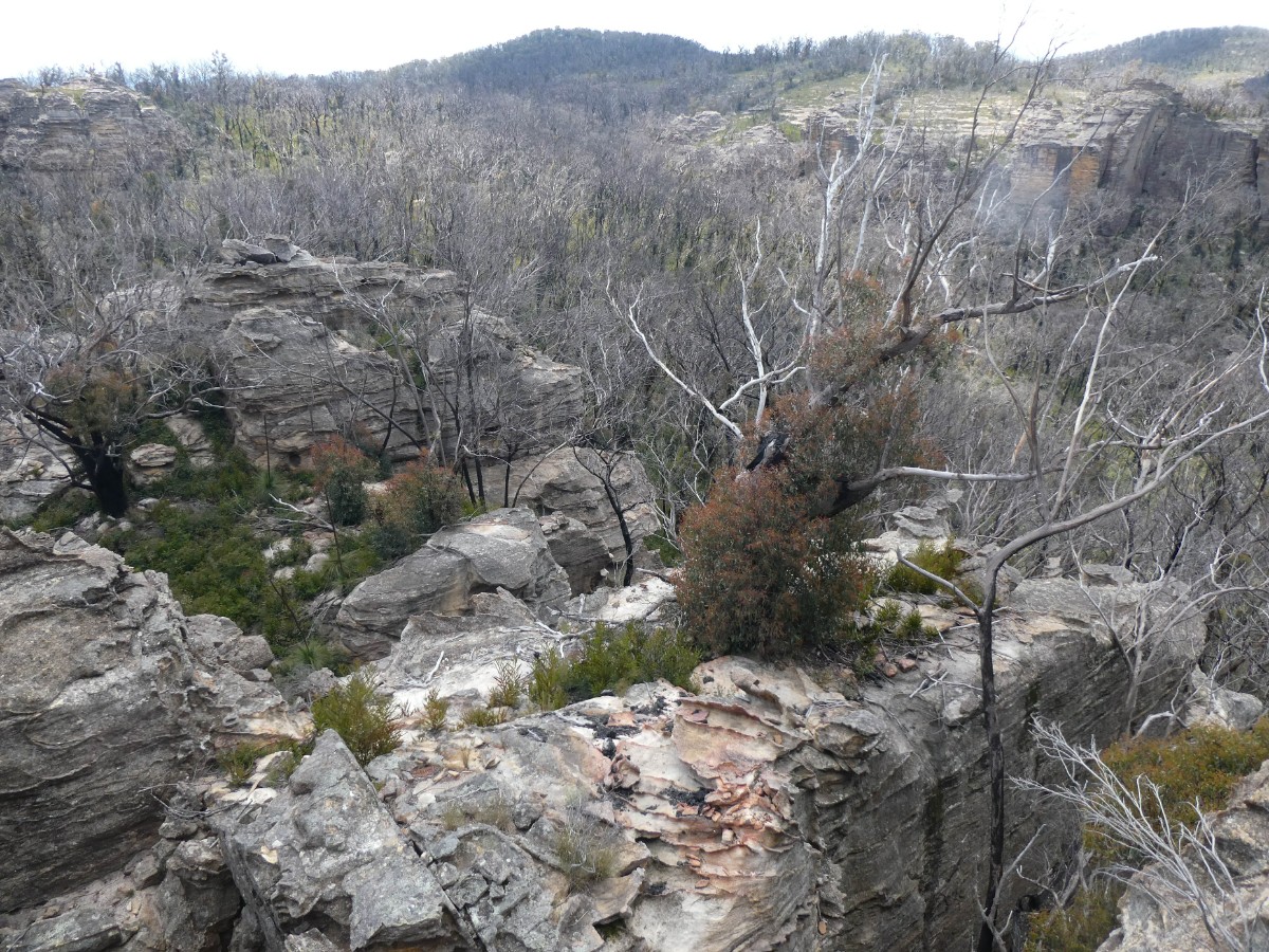
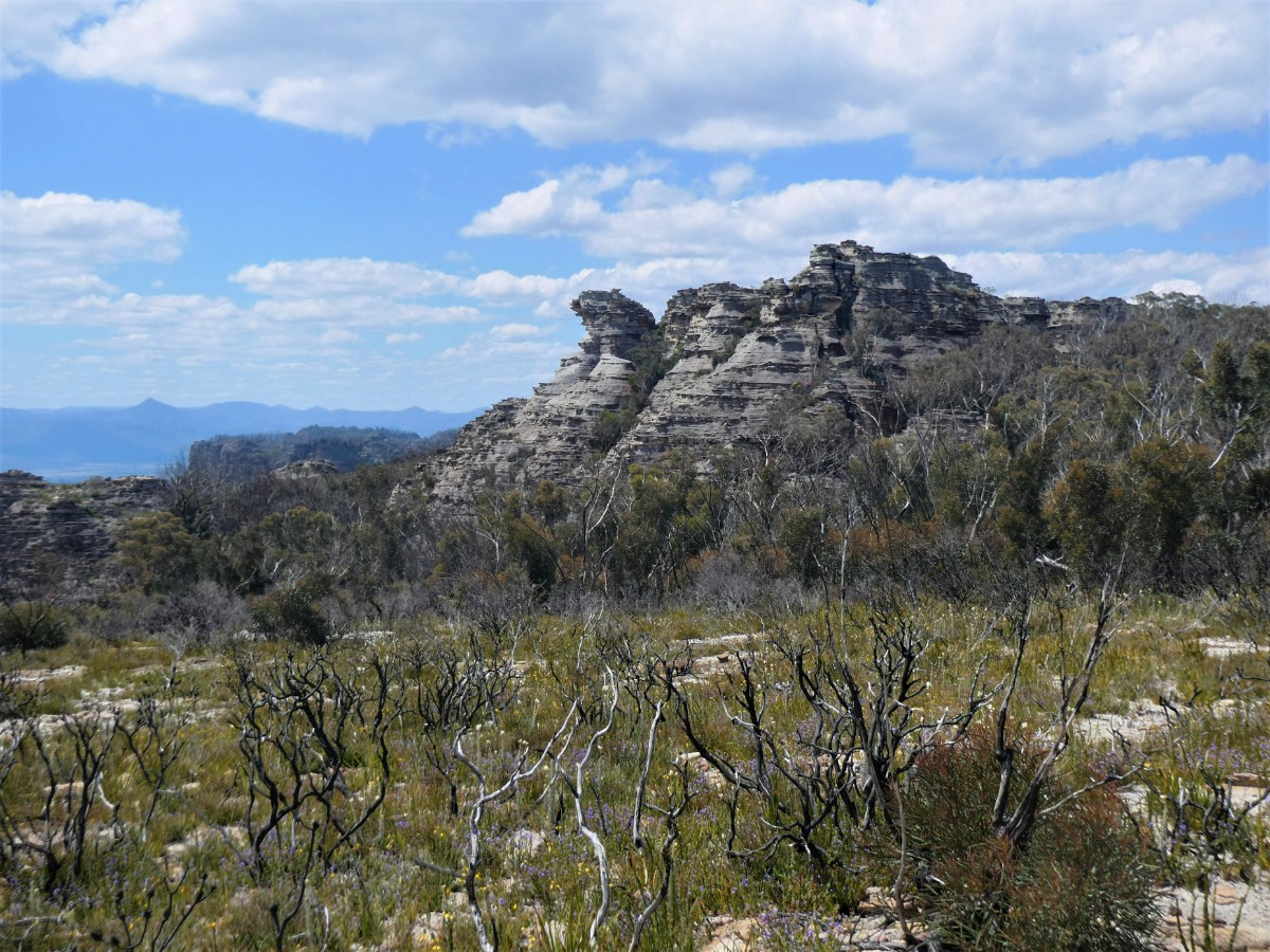
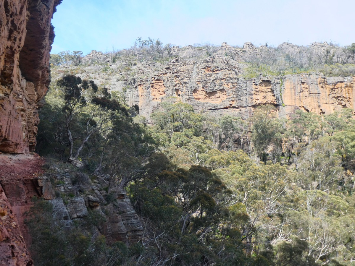
There are huge pagodas everywhere.
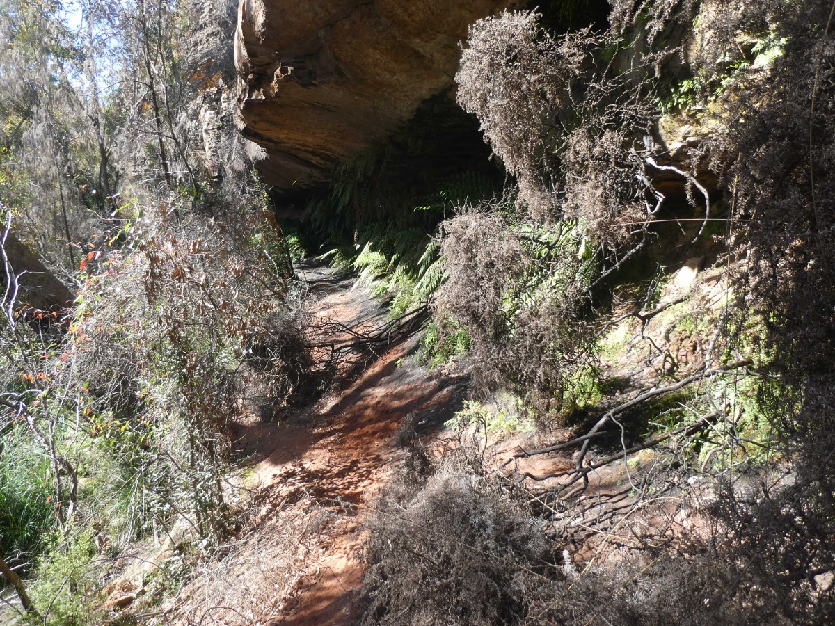
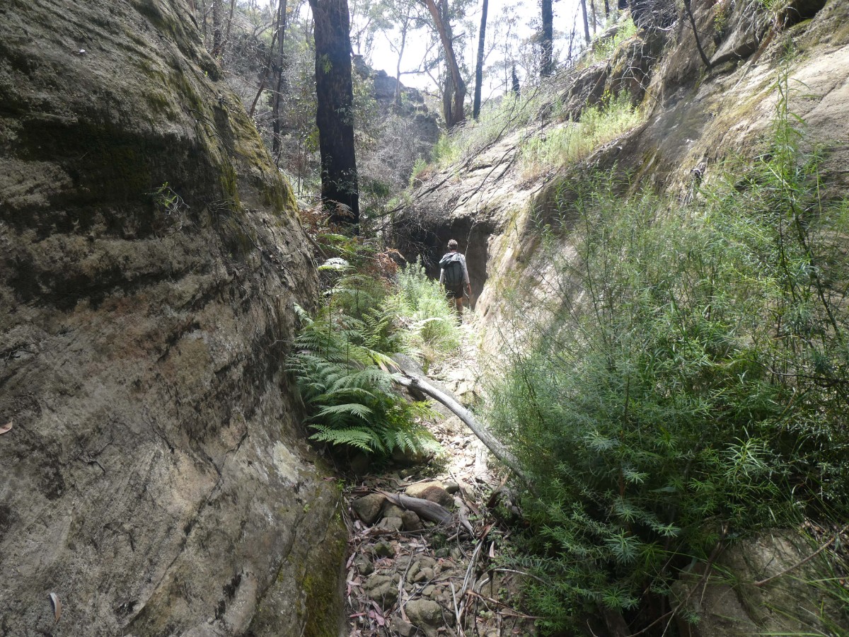
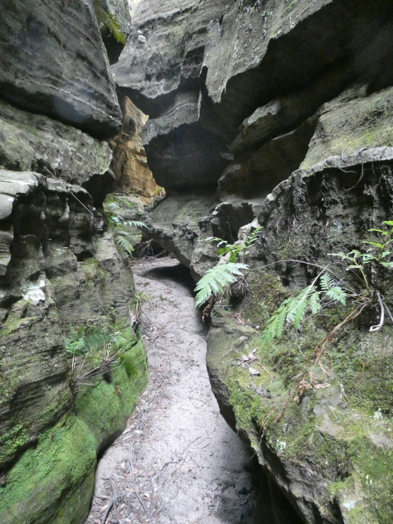
In places there are gorges and canyons with nice formations, decorated with mosses and orchids.
Route
Day 1
Getting to the start
These days the road to Wolgan is closed to all traffic due to landslips at Wolgan Gap. The Emirates Resort is closed indefinitely and residents of the valley have very limited options.
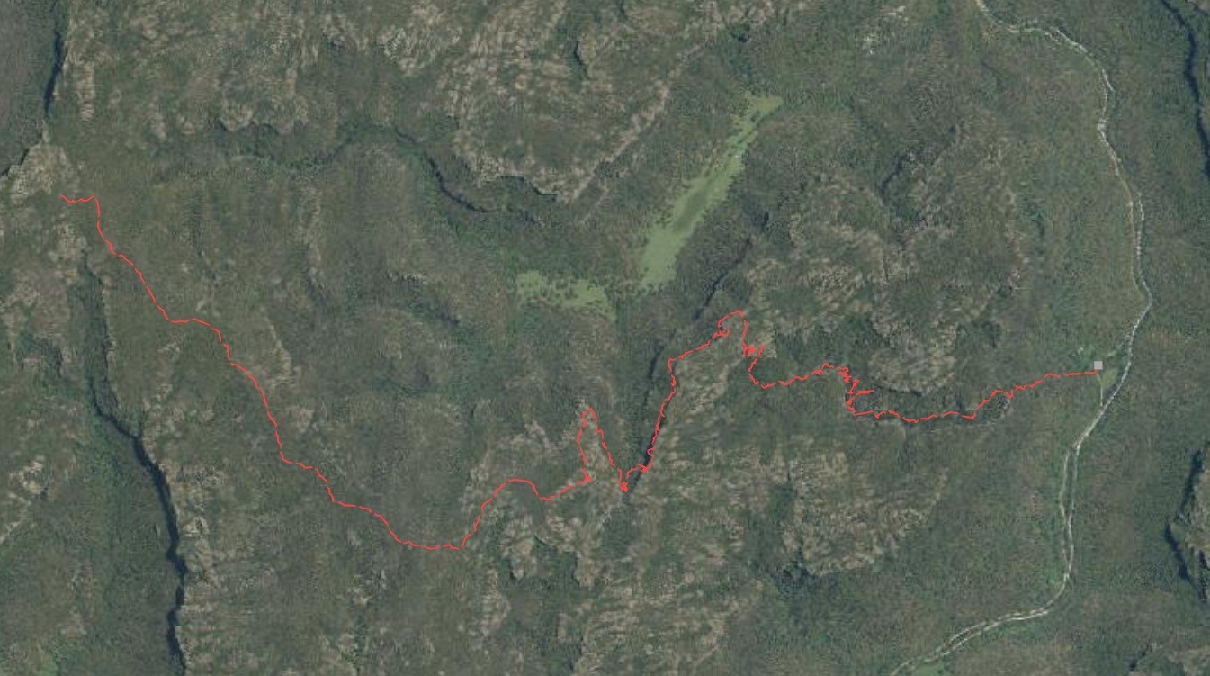
In 2021 we did a 50km car shuffle between Mcleans Pass car park in the South and the exit through Bell Minor Canyon (also known as Minotaurs Lair).
Day 1
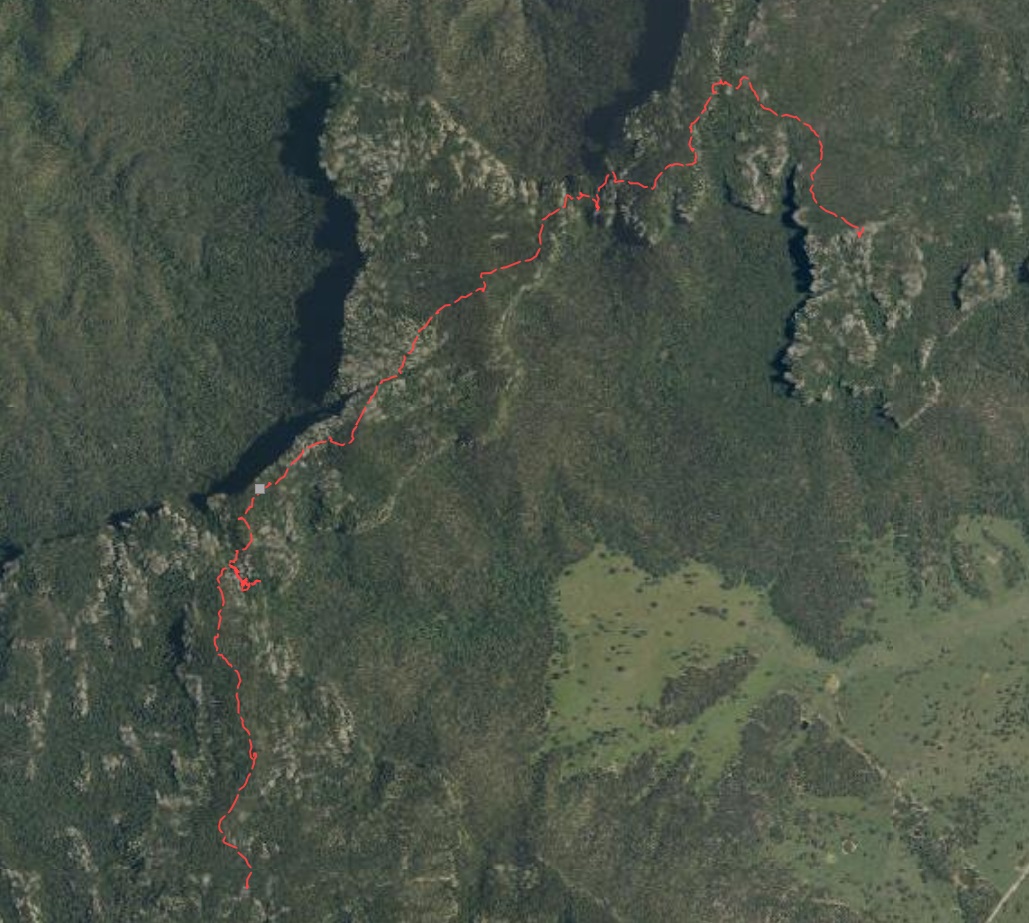
Having left a car at our intended Northern exit, we drove the the car park nearest to Mcleans Pass. The last 15km road requires at least a high clearance 2WD - mostly following the upper reaches of the Coxs River and only intersecting with the Bicentennial Trail as far North as possible. The car park a an obvious level rock area on the right of the fire trail.
We started walking at 2:15, the drive up from Sydney and car shuffle took a while. The faint track up the hill was 50m further along the fire trail. We kept left of the rock outcrop near the top and continued along to track for a couple of kms before descending Mcleans Pass into the gully by 3PM.
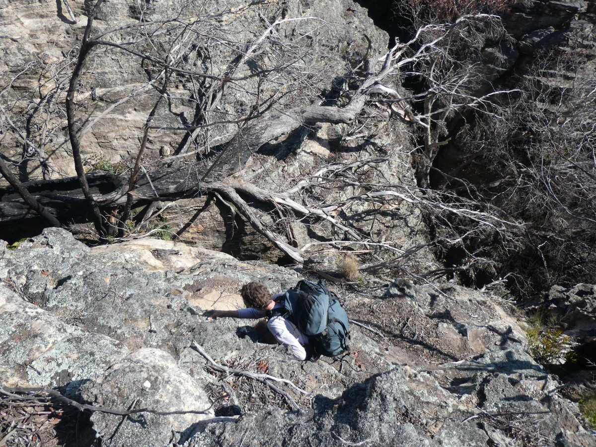
We had to take a 20 minute side trip to the Stargate Cavern and complete the log book 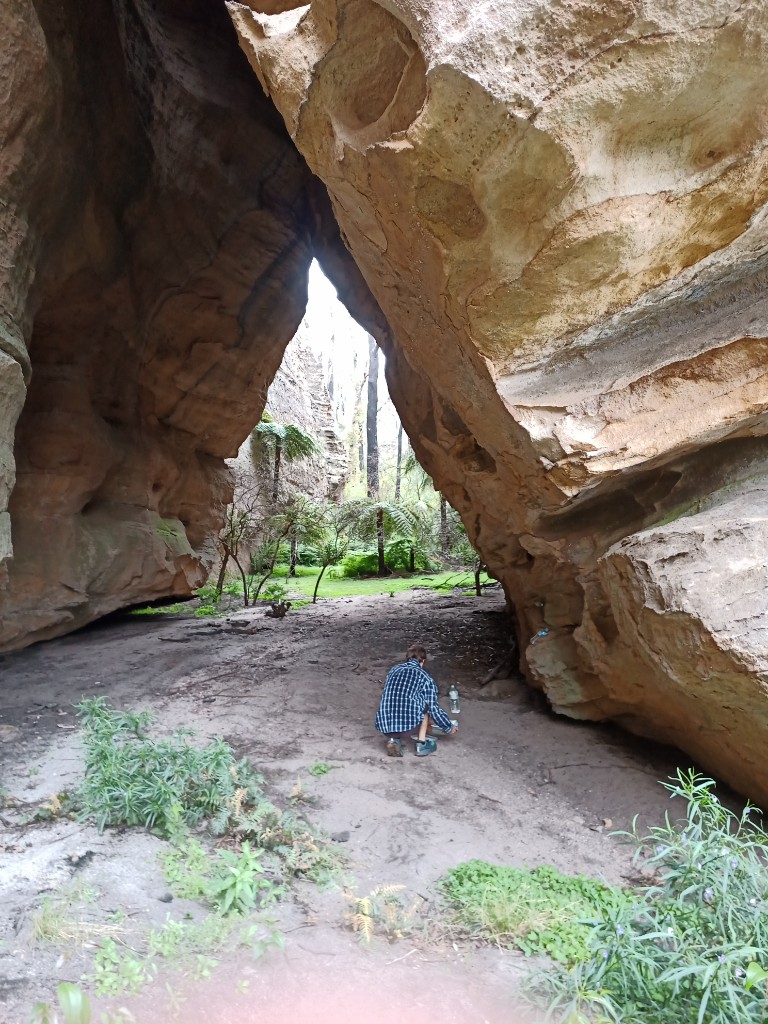
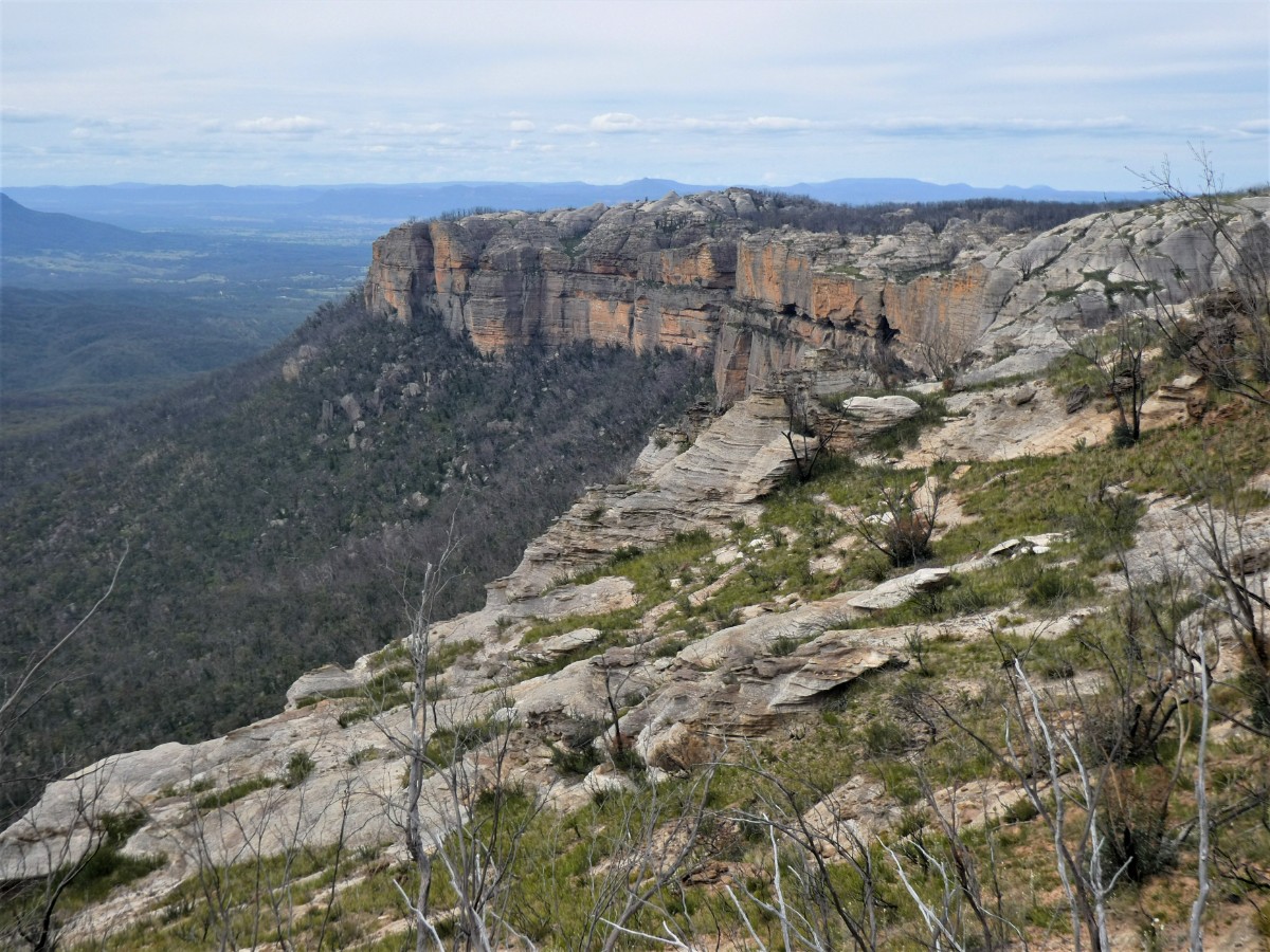
and then gently back up the pagoda on the other side. After regaining the plateau the views started to come alive. There was only sparse vegetation above the mid-storey so much of the valley is and the cliffs overlooking it fill the field of view. 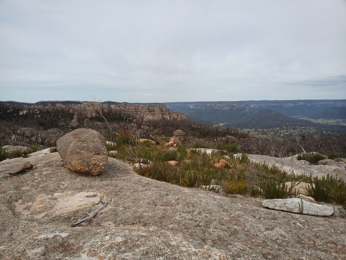
The ridge narrowed offering views both East and West. To the west we could see the unusually smooth pagodas of Point Cameron. Not having time to venture to far West, we vowed to return to explore further.
As the plateau narrows to only 100m, we easily located Hughes Defile, descended and then immediately regained the plateau after traversing Northwards.
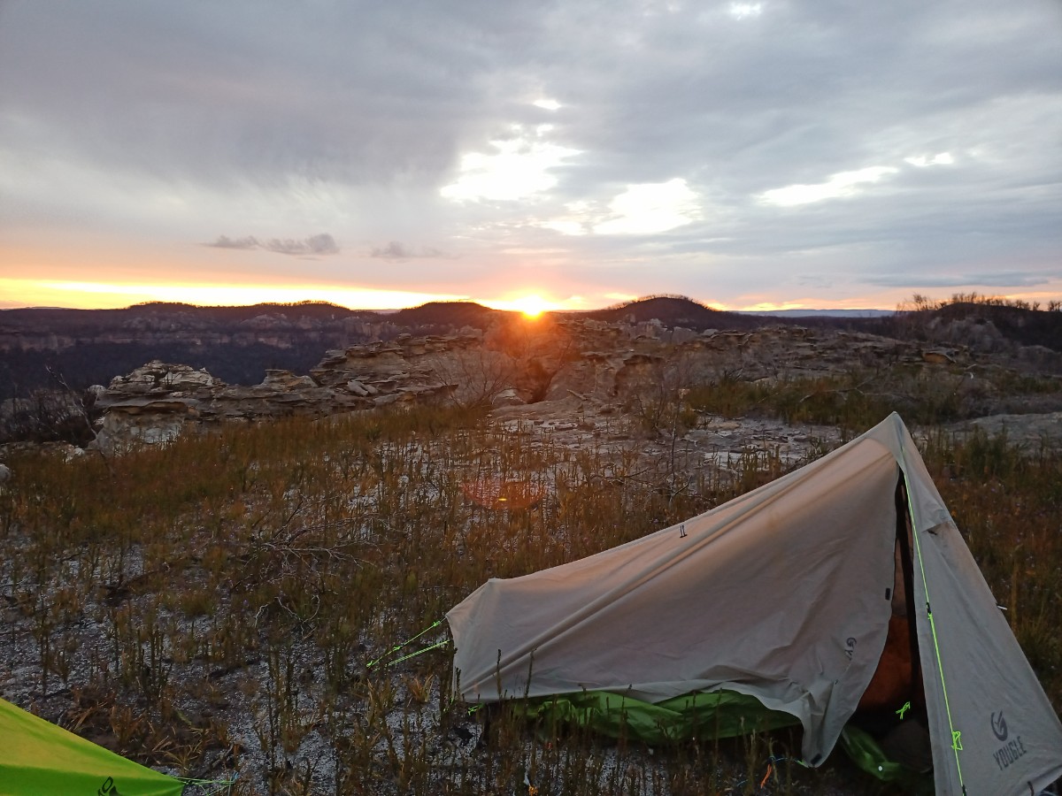
Choosing to camp high the dry with were treated to a spectacular sunset. The views were to the South looking over Alcatraz as far as Lithgow.
The high camp gave us excellent views on a level area.
Day 2 Alcatraz to Mount Davidson
We started day two at 6:45 with an of hour exploration around Alcatraz.
It’s a labyrinth of untouched canyons, pagodas and gullies, with spectacular views to the West and also North and South.
The Southern gully was heavily overgrown with 4-5m tobacco plants, so route finding and views there were tricky and non-existent.
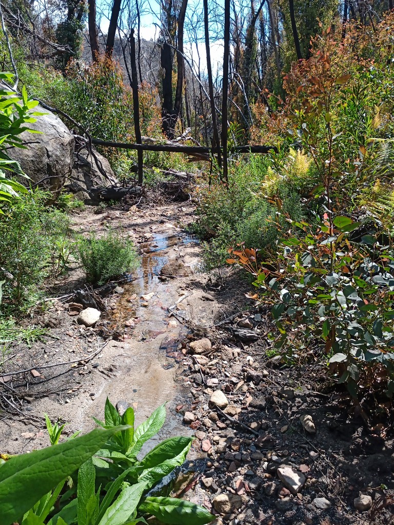
We found the views of much of the Wolgan Valley at the Eastern edge. There was even a trickle of water right at the edge of cliff, otherwise everything was dry. While I collected water from the shallow pool, John spent a little time exploring down the gully. Returning he said it looked like it would go to the valley floor, but involved significant scrub and steepness.
We could see Woolpack Gap and Woolpack Rock to the North from various vantage points.
Returning to our campsite on top of the plateau, we started North towards Woolpack Gap.
We found more water (probably not permanent) in a tributary of Red Rock Creek by 9AM.
And then followed the flowing Red Rock Creek northwards to avoid the cliff lines of Woolpack Gap to the East.
We stopped briefly for morning tea up the tops. 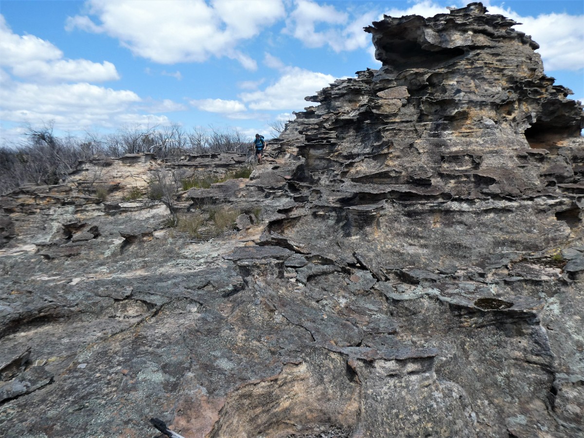
A few hundred meters beyond we descended again - this time steeply into Collet Gap and immediately up again to continue through the deeply dissected landscape.
So far our pass finding had been close to perfect. We broke our streak navigating through the narrower section by choosing to go directly North thrugh some steep pagodas. Only the reach a 20m sheer drop.
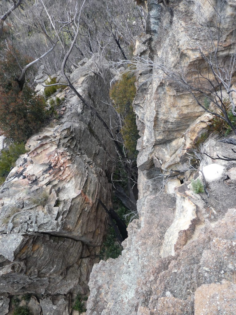
And more deep canyons to follow.
Retreating back down the chimney, we found a way to the West and then North and East into the canyon that had just turned us back. And tried to get over that one, to no avail. Retreating again, a way steeply down to the East before turning North again was successful this time.
This was the last of the tricky pagoda section and from there it was mostly easy plateau towards Mount Davidson.
We had the option of continuing to the big cave and water less than a kilometer ahead, but chose to camp in the shadow of Mount Davidson and collect water for the evening.
Day 3 Mount Davidson to Wolgan Road
We decamped when the sun rose. Most parties doing this traverse continue North to complete the tour of the divide and exit via Little Capertee Creek.
However, we went South East towards our 2nd vehicle, intending to exit via Bell Minor Canyon.
The going was easy at first, through sparse heathland. The route was mostly easy going and level until we turned more Easterly. Then route finding and descents became more challenging. We eventually reached a point on the pagodas where we could see the Grand Balcony below us to the North East. 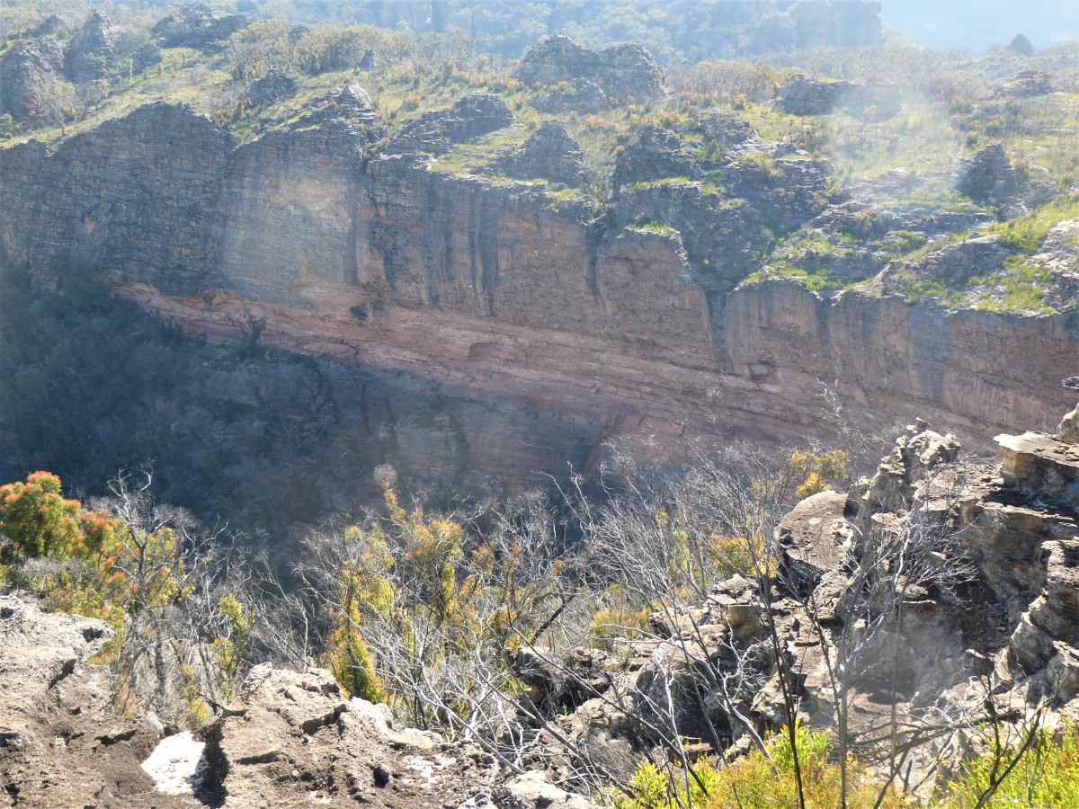
We hadn’t expected to have either time nor to be in a position to do it. However, a 10 minute inspection of the LiDaR gradients and visual of the topography indicated a possible route through the cliff lines directly to our North.
The route did involve a couple of blind gullies and also numerous pagoda crossings, including using a fallen log to cross a 10m deep gap between them.
A slide down a boulder saw us reach the level of the Balcony with easier going along the vegetated ledge.
We also crossed a couple of tiny creeks to refill at. Then at the Southern end of the traverse an obvious wide gully - a quick investigation revealed no easy way in of out.
Heading North along the top of the talus we felt close to the start of the Balcony and rounding a corner it revealed itself
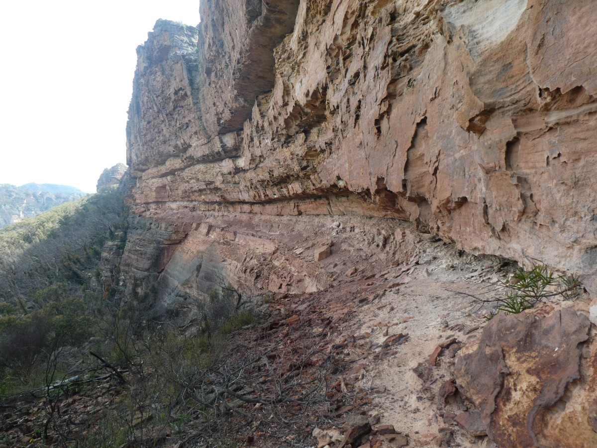
John (blob left of center) made a start
As can be seen it has exposure and underfoot it isn’t particularly level or solid, mostly neither.
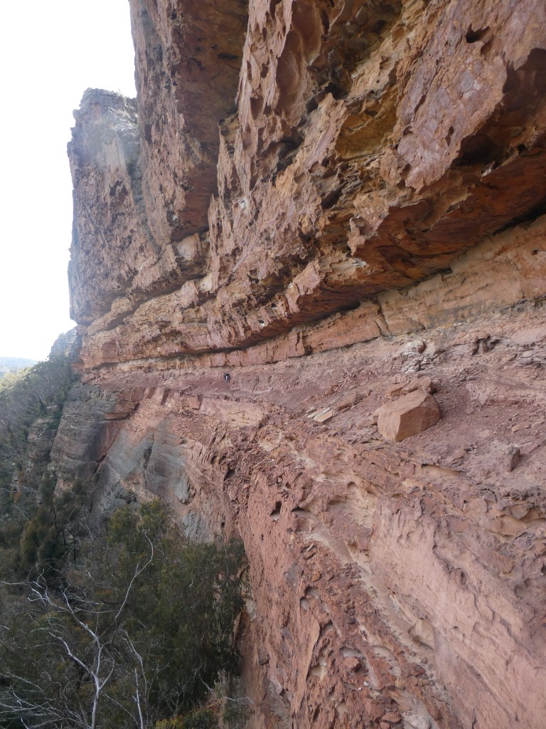
From the N end of the Balcony we looked back at the cliffs and pagodas we had traversed under to get to it.
We continued at the same level, checking every blind gully in our attempts to regain the plateau. It didn’t take long before we were back on top.
Then it was time to find a tributary of Bell Minor Canyon to descend - the first three tries failed,
but the next saw us lose altitude steeply through heavy vegetation into a pleasant side creek.
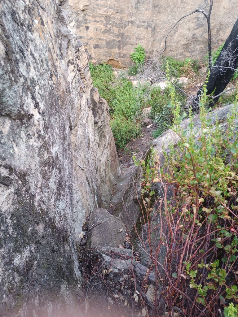
Then the more familiar level base and vertical walls of Bell Minor
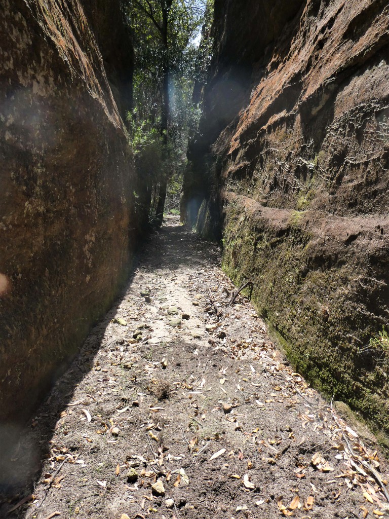
It was all over too quickly - the canyon was easy level walking with only trivial climbdowns and few vegetation negotiation skills required.
The exit to the talus is high on the right - it’s a track of possible doom on an unprotected, slippery and leafy gravel slope above an unhelpful drop.
Bell Minor is usually entered from here & reversed, so most parties have to do it twice.
Stats
Approx 45km
650m of ascent.
Elapsed 2.5 days
Care
Most of the route has little to no exposure. However, there are numerous route-finding and navigational challenges. There are easy exits from the plateau. This is a committing journey.
A single pole or stout stick is particularly handy to provide a modicum of extra stability on the often steep slopes.
The Grand Balcony does have potential for unpleasant outcomes - a good head for heights and exposure is mandatory.