
Rookery Nook
Overview
Rookery Nook is a historic cave on the Mount Hay Plateau that was established by Eric Lowe in the 1930s.
There is some debate about which cave actually is Rookery Nook - there are two or maybe three possibilities.
Cave 1 is close to the junction of Govetts Creek (or Arethusa Canyon) and Lerida Groge (Alpheus Canyon) on the Eastern cliffline.
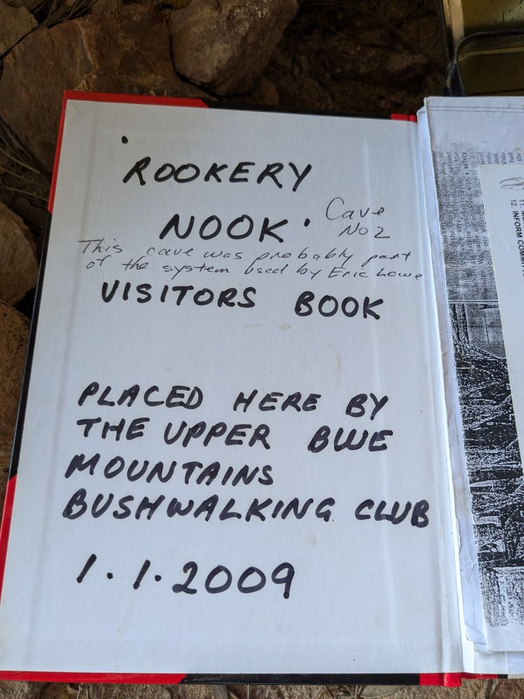
Cave 2 is higher up Lerida Gorge on the Western side and less than 1km from Mount Hay Road.
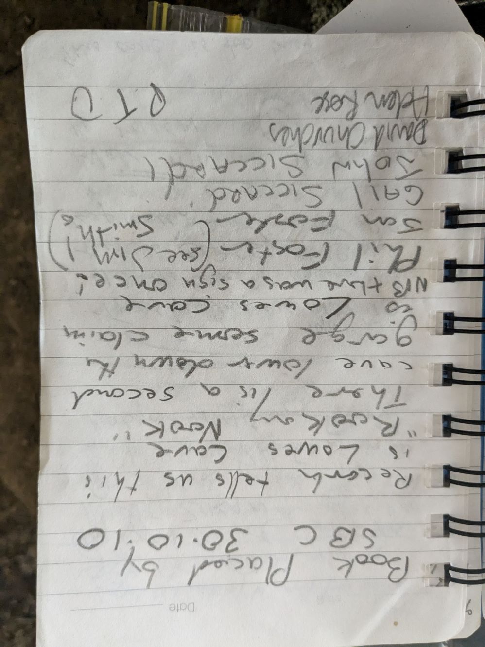
They both have had log books placed in 2009 and 2010.
Other nearby Caves
Darkes Cave, Walfords Cave and Yardleys Cave are all close by. They all contain paraphenalia and/or log books dating from 1900’s and were all established in early 1900s.
Slightly more distant caves that are very likely to have been used for overnight stays include Bindu, Girraween, Box cave, Brownes Cave.
Which Cave is Rookery Nook
There are a few clues about which cave could be Rookery Nook.
The first is an account by Eric Lowe in the Wed 16 Sep 1931 edition of The Sydney Mail. He penned a story about his first Ascent of Arethusa Falls in August 1930 and mentions a cave. This cave is probably Rookery Nook, although the name isn’t mentioned.
He explored the Mount Hay Plateau prior to his attempt.
MANY days of arduous climbing and scrambling were spent in getting to know the country thoroughly in preparation for the final climb. I established a depot in Lerida Gorge — a fine cave, where I kept provisions and sleeping gear, so that it would not be necessary to hump a heavy pack every time I came out to prospect. Lerida Creek runs east of Leura Creek, and junctions with it immediately below Arethusa Falls, pouring into the valley over dark rocks, that even in midsummer are brightened with little more than an hour’s sunlight each day.
After his ascent of Arethusa Falls, he mentions he had been down the Gorge several times.
I knew that if we could work round to the top of Vida Falls we would be almost sure of getting out, for I had several times been down the gorge to the top of the falls, and though on such occasions I had descended fifty feet of cliff with the aid of a rope, I felt confident I could get up without a rope.
On his earlier exploratory trips from the plateau.
Some weeks earlier Osmar White and I had found a long, dead sapling at the foot of the cliff and had propped it against the rock wall to help us going up and down. I am curious about that sapling. It has two steps cut in it, apparently with an axe many years ago. It is obvious that some one before us had been down to the top of Vida Falls. The sapling made it possible for the first man to win to the top of the cliff and lower a rope for the others.
The exit from Arethusa Canyon has two short but tricky climbs in Lerida Gorge.
There were two stiff climbs going up the gorge, but they were nursery climbs compared with those we had just done. We reached’ my cave at 2 p.m., where we rested and fed before starting the eight-mile walk back to Katoomba.
Comparison with other caves
The other caves on the Plateau have varying degrees of utility. There are four main criteria for assessing a caves utility -
- Ease of access - how hard is it to get to, how dangerous/exposed is it and its’ access route, proximity to existing infrastructure
- Presence of bushwalking paraphenalia - the purpose of caves is usually as a place to overnight and explore, but also to store camping gear to avoid humoing a heavy pack every time
- Access to Water - overnight or extended stays are far more practical if water is easily accessible
- Ease of access to surrounding country
More minor issues include -
- original purpose. As a holiday spot, as a base for exploraton or during the war to be used as a hideout for resistance
- accessibility from civilisation
- availability of firewood
- documentation - some caves have been documented
- views - holiday caves prefer good views, while hideouts favour privacy
- availability of a bathing pool - Darkes and RN Cave 1 have deep pools closeby
- roof height - a low roof makes it impossible to sit comfortably and also smoke isn’t easily dispersed
The evidence pointing to the likelihood of Cave 1 being the ‘real’ Rookery Nook seems overwhelming. Cave 2 is poorly located, less accessible, has little comfort, no firewood or water or bathing.
Apparently, there was a sign indicating that Cave 1 was the real one.
| Cave | Access to water | Access to surrounding area | Ease of access | Paraphenalia |
|---|---|---|---|---|
| Walfords | Plumbing | OK | Good | Lots |
| Darkes | Good | OK | Good | Lots |
| Yardleys | Good | OK | Good | Little |
| Rookery Nook 1 | Good | Good | Good | Some |
| Rookery Nook 2 | None | Poor | Poor | None |
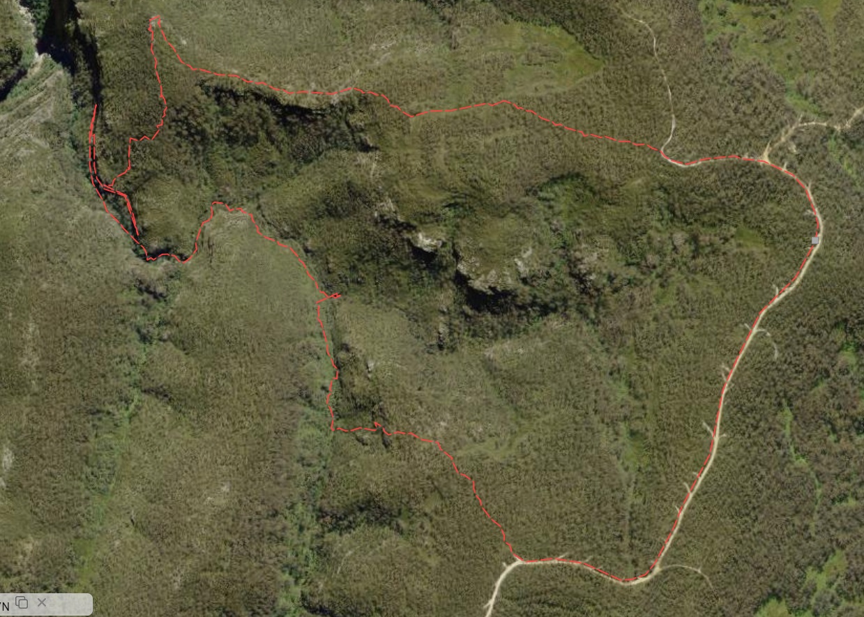
Route
This trip visited Cave 2. Fortress car park was the start point. The route heads along the ridge to the knoll and descends South. Bearing West hit the upper cliffline and after a couple of false Northbound attempts the correct gully and ledge was found.
The gully ends quickly as does the Southbound ledge attempt.
Walk In to Cave 2
Parking at Fortress Car park it is a short steep walk up the the top of the hill. At the first sharp right leave the fire trail and proceed West along the easy ridge for about 1km to the low knoll that marks its’ end. There are faint pads in various places especially towards the end. And it’s often easier going on the right hand side of the ridge.
A short distance beyond the knoll are views of Arethusa Falls, Medusa Falls and Vida Falls from the cliff edge. However, the access to the cave is sharply South from the knoll and steeply down. Finding the right gully isn’t apparent, but aiming slightly West will inevitably hit the cliff line, forcing all progress to be to the South East. And the first dry gully has a faint dusty track down to a low cave on the right.
A low cave in the gully marks the start of the ledge to Cave 2
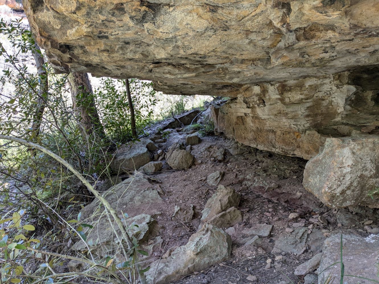
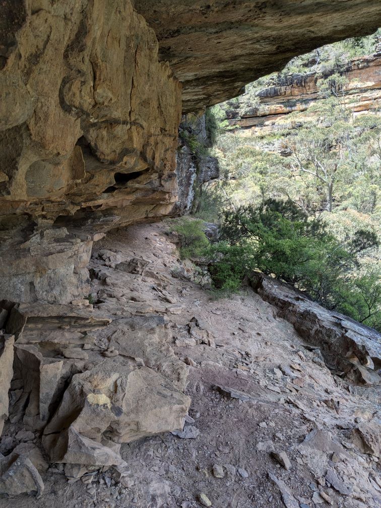
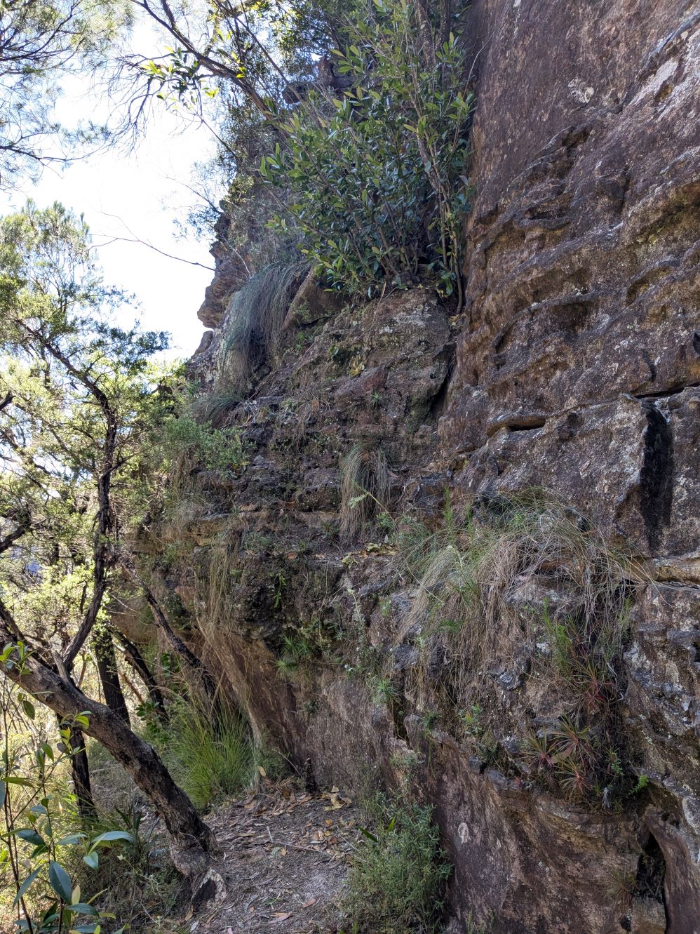
Once past the cave, contour with care North along the chocolate ledge.

It becomes low and narrow with loose claystone underfoot.
It’s often low and always close to the 20m drop into Lerida Gorge. Carrying an overnight pack would require crawling.
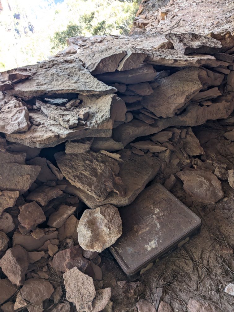
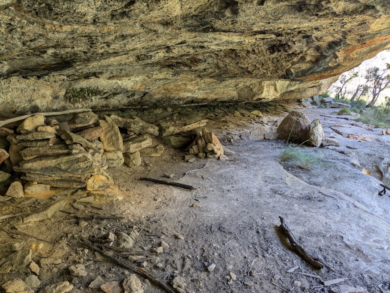
After less than 100m it widens and deepens to a small and fairly level platform with a low wall built on the Northern side.
There’s no sign of any paraphenalia, nor a fire ring.
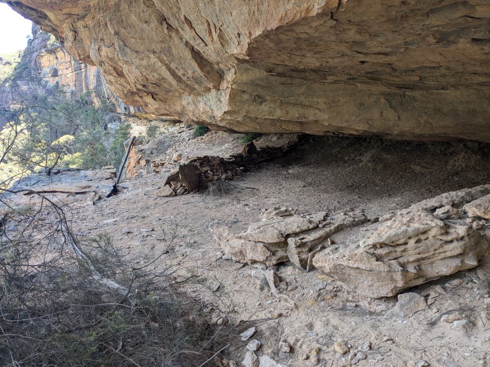
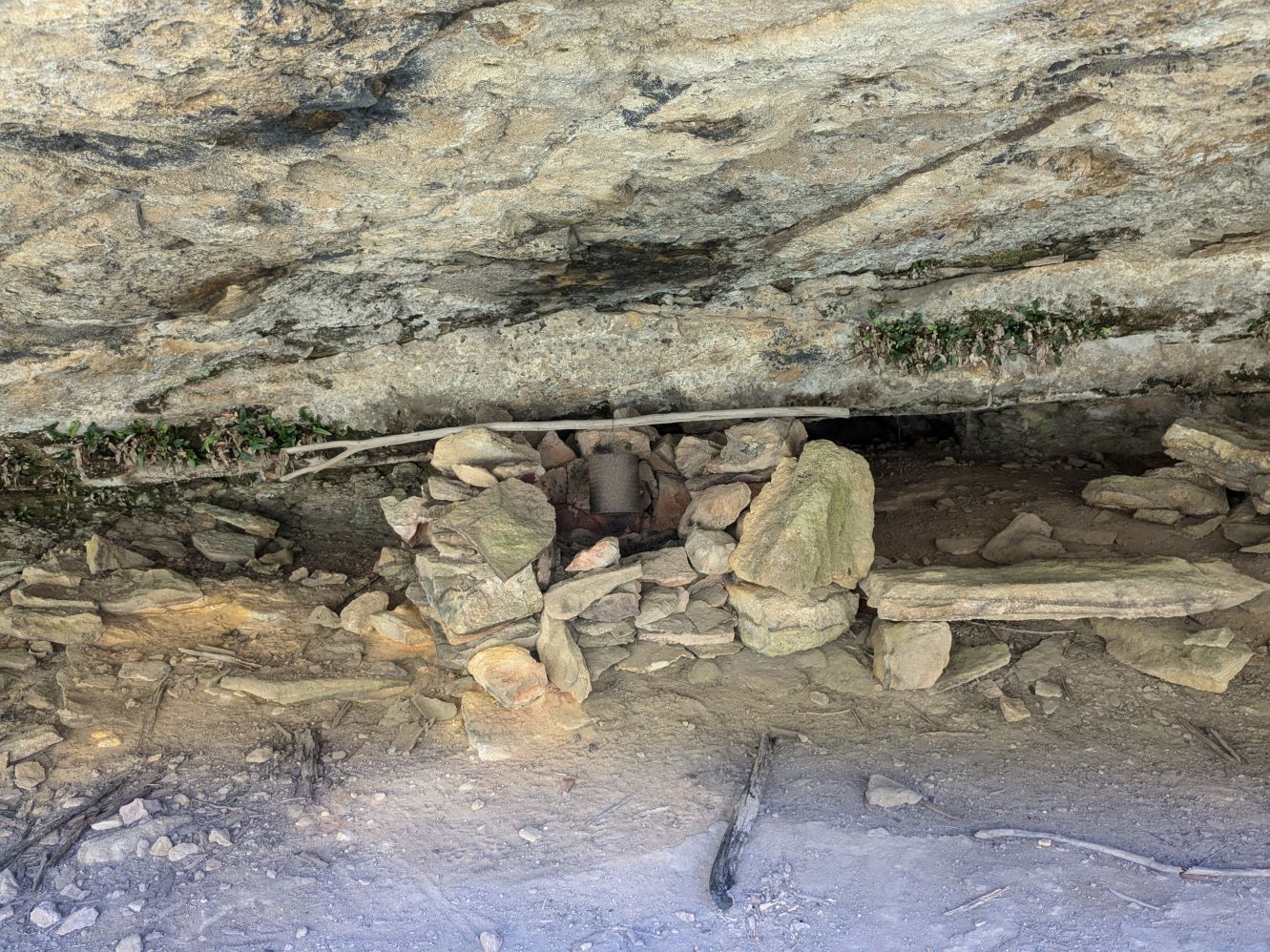
The visitors book is in an inconspicuous rusty biscuit tin hidden in the shadow of the wall.
It’s rarely visited - the book was placed there in 2009 and has only 10 pages completed over 15 years. There’s a high proportion of repeat visitors.
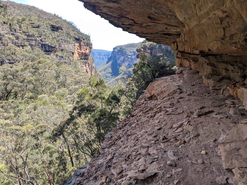
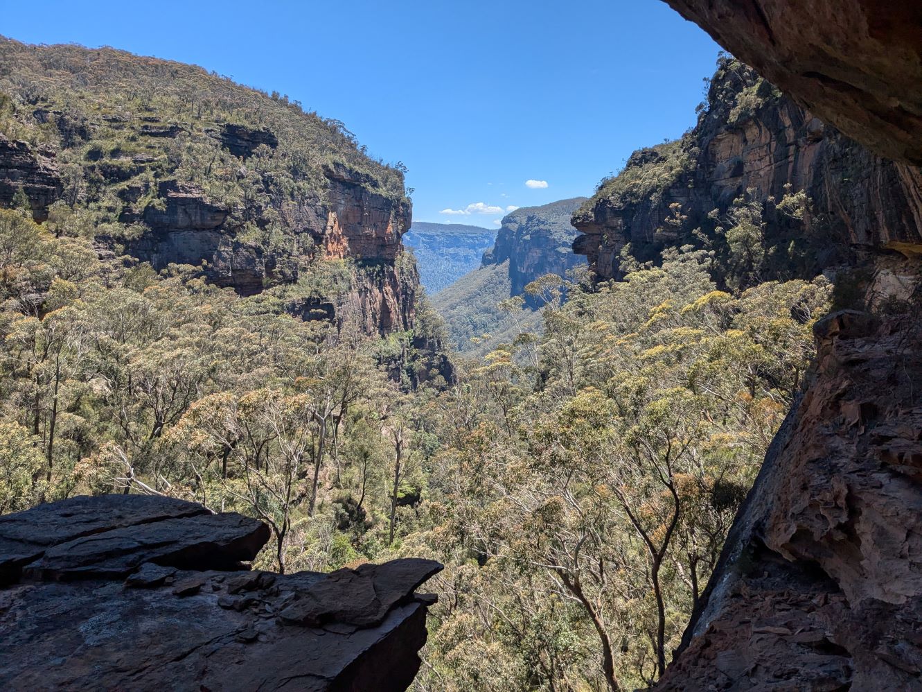
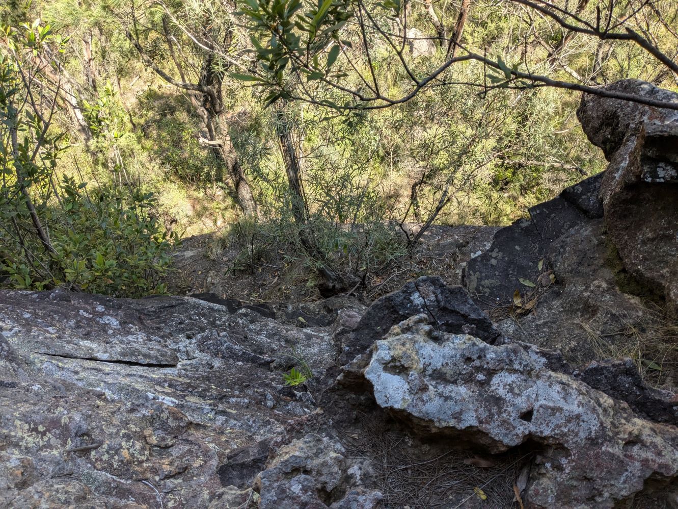
Views towards Govetts Gorge and into the valley are unobstructed but limited as the cave is a fair way up the gorge. The ledge ends immediately afterwards.
Apart from an abseil or climb, the only return option is back along the ledge.
It’s less than 200m across to the other side of Lerida Gorge where sections of the canyoners exit track can be seen.
Returning to the low cave at the base of the gully, the ledge continues upstream for 150m. However, at its’ end it is still 10m above the creek, with absolutely no options to descend to exit via either the gorge or the canyoners route.
Route to visit both Caves
An alternative route that visits both Cave 1 and Cave 2 also starts at Fortress car park. Walking back along the firetrail for 1.2km find the ridge at spot height 916m and head NW, then W to descend steeply into the creek. Follow the creek for 600m around the sharp left hand bend along the steep and grassy banks. As the gorge narrows caves appear on both banks, and Rookery Nook Cave 1 appears only 10m from the creek on the true left.
Cave 1
Cave 1 has a cooking fire with an old billy.
 The visitors book was placed in 2010. It has only half a dozen pages of entries up until late 2024.
The ledge where cave 1 is located is wide and level with a good height roof. Probably space for a dozen overnighters.
After visiting Cave 1, continuing down the gorge immediately finds a deep pool that can be avoided on the left.
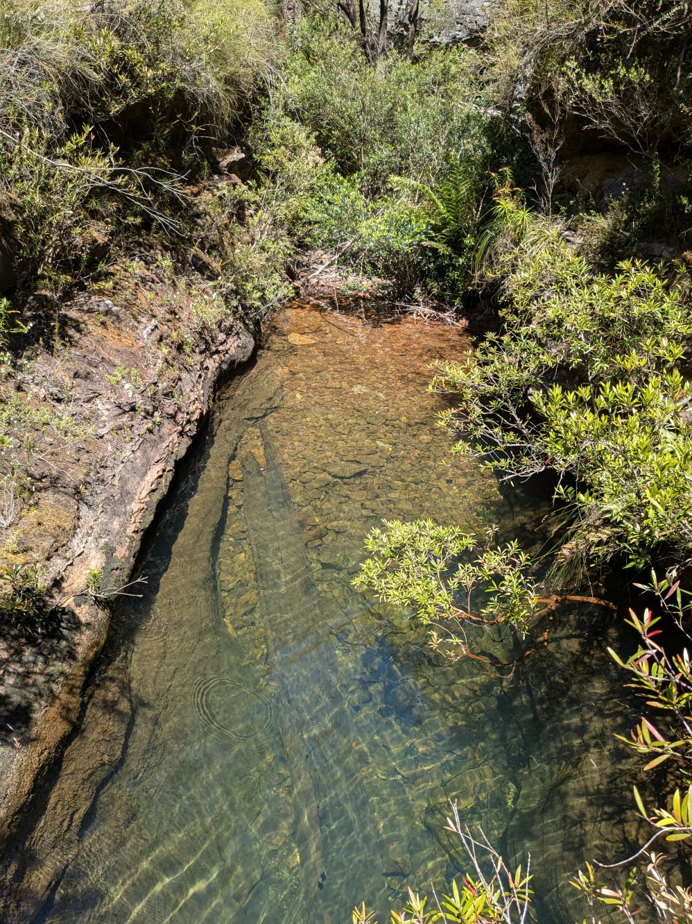
From there, the gorge becomes more pleasant - keeping to the right bank it follows a claystone band up until the easy climb
The climb looks tricky, but it has plenty of hand and footholds and only a little exposure.
After reaching the ledge, looking back down the short climb into Lerida Gorge
The cave is but 10m further. The exit from here is upstream along the ledge as per the previous route.
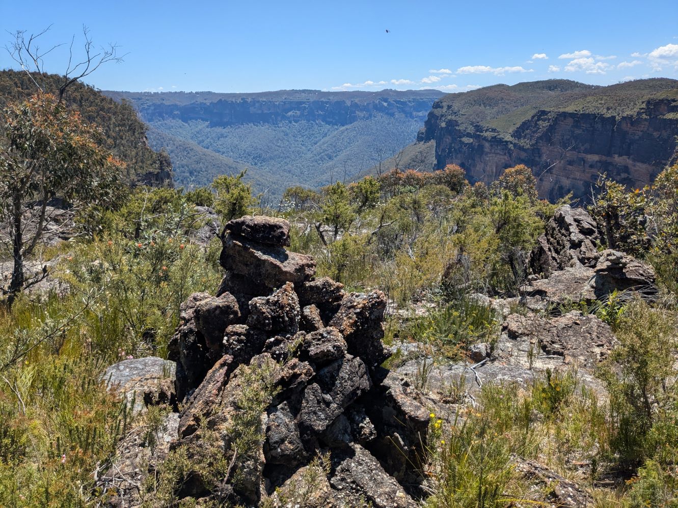
After reaching the knoll, the direct route back to the start point is to head East along the ridge. However, there are a few more features to be seen by contouring NW just below the knoll. There is a sizable cairn and several rocks that afford views up Arethusa canyon, out to Govetts Gorge and Lockleys Pylon, and also East to Fortress Ridge and Fortress Lookout.
And hence returning via the ridge to the car park.
Alternatives
An alternative to the loop, is to park at Arethusa canyoners car park and follow the ridge directly over the roof of Cave 1 and then drop into the gorge. This avoids the mildly unpleasant creek walk, although a car shuffle may be preferable if planning to exit via Fortress car park.
An alternative exit to consider is via the Arethusa Canyoners route.
Stats for Cave 2
Less than 5km
~150m of ascent.
Elapsed 2:00 hours
Stats for Cave 1 Loop
About 6km
~250m of ascent.
Elapsed 3:30 hours
Care
These are routes that are mostly trackless bush bashing, so navigation skills are mandatory.
They have 100m of exposed ledge with significant exposure and loose footings. A good head for heights is recommended.
There is also an easy though slightly exposed climb between the two caves.